Nine Zeballos residences remain evacuated as the North Island village lingers in a state of emergency due to landslide threats after a mountainside fire ravaged 128 hectares over the summer.
The fire was sparked by a lightning storm in mid-August on the mountainside over the Village of Zeballos. After the fire was controlled, residents were ordered to remain evacuated due to landslide risks on Sept. 8.
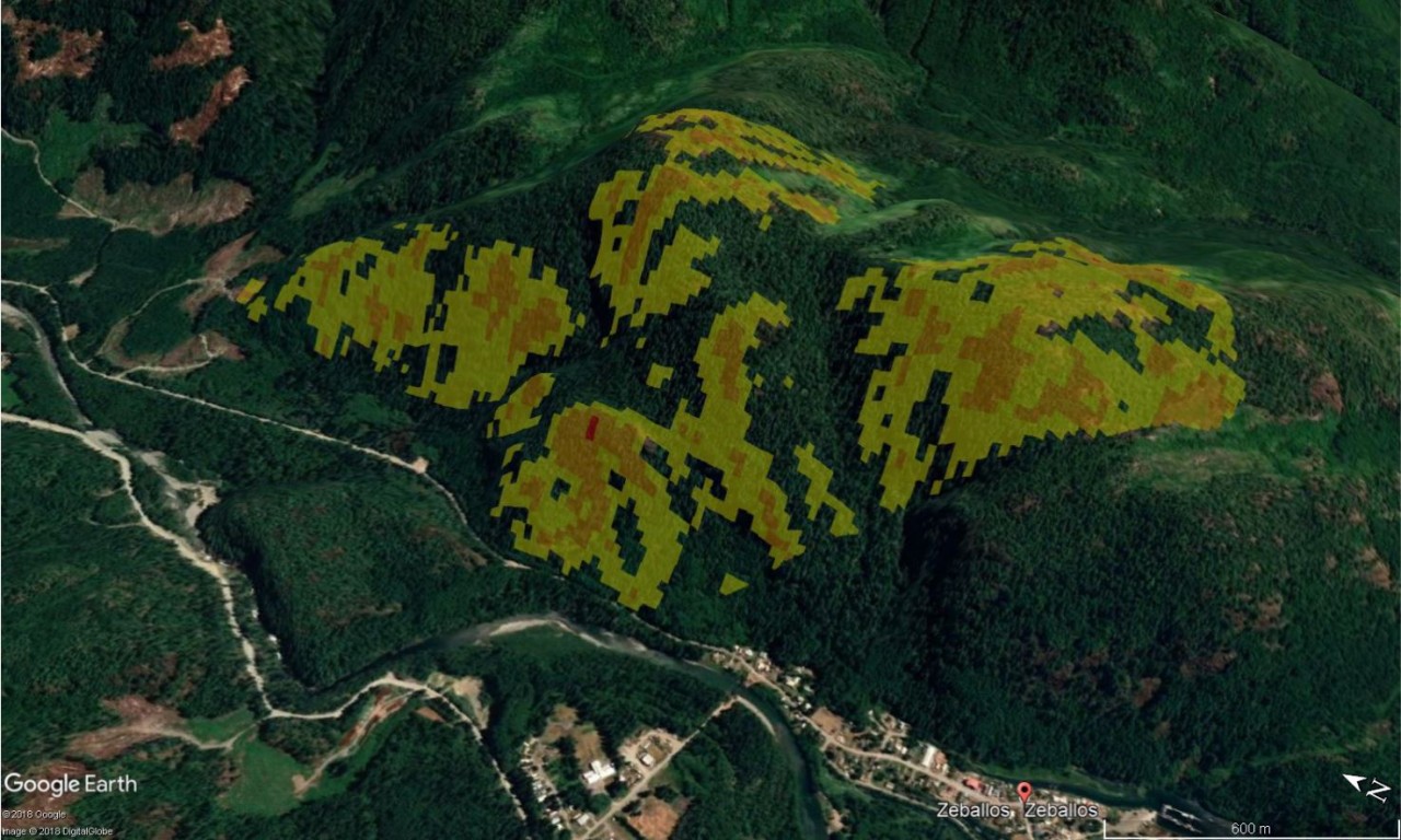
After the slopes were damaged by the fire, the Ministry of Forests, Lands, Natural Resource Operations and Rural Development inspected the steep terrain to find out the risk of land and rock slides.
The ministry published a preliminary post-wildfire analysis to determine the risks, stating rockfall and debris flow as the most pressing post-fire natural hazard at the site.
The village’s CAO Meredith Starkey said so far, there are no signs of an active slide, but residents need to wait for a final report from the ministry before returning home.
“Unfortunately we don’t have a lot of information yet, we’re still waiting for the report on slope assessment from the province,” Starkey said.
The preliminary report from the province states the Gold Valley Main fire was patchy, with a few areas of high-burn intensity, but primarily low-to-moderate burn intensity with substantial unburned areas.
Steep bluffs and open slopes are the dominant topography and there are two large gullies in the southern portion of where the fire was burning.
“Open slopes and bluffs are likely to produce rockfall. Gullies may produce debris flow,” reads the report. “It is likely that some areas (of Zeballos) will be exposed to moderate or high risk.”
Maquinna Avenue, the road directly under the slope, is potentially subject to increased rockfall as a result of the fire, the ministry reports. Woody debris and a few rocks have already landed on the road.
“Future rockfall is likely due to the very steep, exposed, jointed rock and burned forest,” states the analysis.
Starkey said Maquinna Avenue remains closed as a through road.
“It is open if we need to evacuate, but there is an alternate route out of town so we’re just asking people to use the alternate route in the meantime,” she said.
Mitigation efforts have not yet been outlined by the province and Starkey said they’re hoping to see a final assessment this week.


