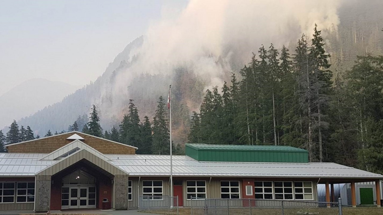
Twenty-one individuals remain evacuated from their Zeballos homes after a final post-wildfire report from the province deems the steep eastern slopes ravaged by fire over the summer at high risk for landslides.
The 128-hectare mountainside fire led to an increase in landslide risks, thus the Village remains in a state of emergency.
The Ministry of Forests, Lands, Natural Resource Operations and Rural Development, released a 50-page geohazard report, prepared by the consulting firm BGC Engineering, last week that said risk of falling debris and rock from the slope increased tenfold.
“BGC estimated a tenfold increase in debris flow and rock fall based on the burn severity observed on the forest floor and the quantity of rock falls that reached Zeballos Main Road during the fire,” states the report.
Village CAO Meredith Starkey said rocks and trees have been noticed falling down the slope, therefor the Ministry of Transportation and Infrastructure has closed Maquinna Avenue.
“Things are coming down, you can see them on the slope but they haven’t necessarily come all the way down to the road,” Starkey said. “The concern identified in the report is that those things can build up and then you could have a major storm event and that could push [debris] down.”
Starkey said Village staff have limited ability to mitigate any of the debris flow themselves as the slope is deemed unstable.
“We can’t send anyone up there to fall trees, we’ve looked in that, or some of the easier or simpler mitigation options, but even that we can’t do,” she said. “It’s not safe for anyone to access the slope.”
Starkey said she doesn’t know when residents will be able to return home but that there is a meeting planned in November with the province and evacuees that will give everyone a better idea of what’s next.
Ehattesaht Chief Councillor Rose-Ann Michael said to her knowledge the province hasn’t made any efforts to mitigate geohazards.
“All parties involved plan to meet Nov. 9 at the earliest. I personally don’t foresee any answers after they meet,” Michael said. “There is a lot to consider for everyone’s safety.”
According to the final report, slope hazards are most commonly triggered by periods of intense rainfall and earthquakes.
The report offers several mitigation options for slope hazards, but the only one deemed to be practical is to implement protocols to manage and limit risk if a disaster occurs.
“Looking at table c-1 of the final draft post-fire assessment it’s clear in my view there is not much that can be done,” Michael said.
Other possible mitigation efforts described in the report include to remove or stabilize unstable rock and debris, elevate a creek bed to stabilize side slopes, redirect flow away from the village and improve a defined travel path to guide debris to a desirable location are offered in the report - but all are said to be ineffective.
The assessment offers the options to relocate properties that could be effected by debris fall.
“Should the village decide that risk to certain properties remains intolerably high, relocation of some properties may be an appropriate response. This has already occurred with the old high school which is now located in west Zeballos,” states the report.
The report also states that “monitoring slope deformations can provide advanced warning of impending rock falls, rock slides, and debris flows. Thick vegetation limits the usefulness of most remote sensing techniques and the best tool may be periodic visual inspections by a qualified geohazard professional,” states the assessment.
Michael said she is not looking forward to the West Coast storms “that will be coming soon.”


