Tseshaht First Nation has completed a project to stabilize the slope above Pacific Rim Highway just past the Somass River bridge. And to date, Tseshaht has been forced to absorb the full cost of the work, according to Planning and Public Works Administrator Lisa Gallic.
“We did it on our own – our own capital,” Gallic said. “We received no money from highways [provincial].”
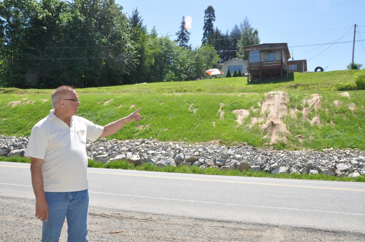
Gallic said when the road began to deteriorate after serious flooding in 2016, Hugh Braker put the plan into motion in his capacity as chair of the Tseshaht Emergency Preparedness Committee.
Braker explained that the reserve road was converted from an old logging road to residential, and has had a history of instability.
“That roadway began to crack right down the middle of it,” Braker said. “The side closest to the river started to slough away and sink down towards the river.”
Braker said the process is natural and predictable, but something had to be done, or the roadway could have collapsed and slid down the embankment.
“Plus, during heavy rains, it would become very dangerous,” he said. “Pacific Rim Highway runs right along the river, and thousands of cars pass through there every week. God help us if there were vehicles or a bus on there [in the event of a slide].”
Braker added that the band contacted federal departments in Ottawa for help.
“So we approached Indian Affairs, we approached the Transport Ministry [Ottawa], we approached the Highways Ministry – B.C. – and we couldn’t get any help from anybody,” he said. “They said it was our problem.”
With no outside funding available, Tseshaht approached the Nuu-chah-nulth Tribal Council, which block funds infrastructure projects.
Aaron Humen serves as NTC Capital Projects Advisor and is a certified environmental technologist with 15 years experience.
“There was an EMP (provincial Emergency Services) report that was done in 2016,” Humen said. “It stated that there was an instability in the bank.”
The flooding in 2016 caused the bank to be unstable. Humen explained that the geologists contracted by McGill Engineering discovered that much of the soil was glacial till, which does not pack like ordinary soil.
Humen said there has been one sticky point in negotiations with the Ministry of Transport.
“In order for MoT to fix the highway, they would have to have ownership of the highway,” he explained. “MoT and Tseshaht have an agreement where nobody claims ownership – I don’t know if it’s written – but that’s what came out of the meeting.”
MoT maintains the road surface, cleans the ditches and clears the snow in the winter, but as far as funding an infrastructure project, no such luck.
“We got started very quickly because we had to have it finished before the fiscal year end, which is March 31,” Humen said, adding that the project was expected to take two weeks.
As in most engineering projects, the plan “evolved” and the design had to be adjusted numerous times as the “unknowns” turned up.
“We had some delays and a few communication issues, but we got there,” Humen said, adding, “And it’s a good product.”
Bowerman Excavating performed the actual digging and hauling. Speaking briefly to Ha-Shilth-Sa, owner Craig Bowerman said he wouldn’t take credit for the innovative nature of the project: his crews followed the engineering plans as set out and modified by the engineering team contracted by NTC.
According to Humen, that meant trimming the “overburden” at the crest of the hill and removing that troublesome glacial till from the bank.
“Originally, we thought we would have to fill the bank with rock,” he explained.
Instead, the contractors created a two-metre rock wall at the base of the slope (known as “armouring”) and replaced the existing culverts.
“Tseshaht decided to remove the big trees,” Humen said. “We left the roots in, otherwise we would have been removing half the bank.”
To prevent erosion, the new bank surface was hydro-seeded. The seeding was then covered over with cocoa mat, to create a tough organic layer to diffuse water flow down the slope.
Braker said the remedial work takes care of the most visibly threatened area, but there is more work to be done.
“The work is completed for that particular problem. But the problem continues towards McCoy Lake Road,” Braker said.
During the big flood of 2014, a section of the bank slid down the hill, carrying several trees.
“It knocked out the electricity. One of the poles hit a light standard,” sai Braker. “We had a real mess up there, and we had to get our forestry crew in immediately to cut up some of those trees and to try to stabilize the bank a bit.”
Braker said Tseshaht commissioned a geologist to determine what would be required to make the road safe.
“They’re about halfway through and I don’t know where we’re going to get the money for the rest of it,” he said.
“So I am going to approach Indian Affairs again. I talked to a guy from Ottawa about a week and a half ago,” Braker said. “He has invited me to do an assessment or a proposal, or a study on stabilization – what’s going to work best for us. I don’t know why they need another study; we’ve already had a study done. We just need the work done.”
Braker said one of the added threats is to the ancestral Tseshaht cemetery located just beyond the home of the late elder, “Wee Willie” Sam’s home, overlooking the corner of McCoy Lake Road and Pacific Rim Highway.
“We have a large number of ancestors buried there,” he said. “It’s still okay. But that’s why it’s so important for us to stabilize that whole hillside… it would be disaster for us if that came down. It would cause an awful lot of people heartache.”


