With a long and hot summer expected, those who keep a close eye on Vancouver Island’s rivers are seeing a crisis unfold.
Watersheds are being impacted by drought conditions with a Level 3 out of 4 severity across the island, according to the BC Ministry of Forests, Lands, Natural Resource Operations and Rural Development. The province released an advisory in mid June, stating dropping water levels due to heat are expected to continue in the coming weeks. Some of the streams affected are crucial for salmon populations.
“The Somass River is already low, and our river is already above average for the water temperature,” said Tseshaht Councillor Hugh Braker during a Council of Ha’wiih Forum on Fisheries in Tofino June 12. “Twenty-three degrees is fatal to sockeye.”
Braker, who represents Nuu-chah-nulth on the First Nations Fisheries Council, stressed the severity of the situation as salmon migrate into Vancouver Island’s rivers and streams this month.
“There’s now a crisis developing on Vancouver Island with respect to water,” he said. “Environment Canada is predicting a long hot summer. If all predictions are correct, that crisis will extend from the northern tip of Vancouver Island to the southern tip.”
The Gulf Islands are also under the province’s drought advisory, which could lead to mandatory restrictions on water usage.
“If voluntary reductions of water use are insufficient to maintain flows above critical levels, the province may consider regulating water usage under the Water Sustainability Act,” stated the Ministry of Forests. “Specific actions could include temporarily suspending water licences or short-term water approvals to restore flows to minimum critical levels in the affected streams. Ministry staff are contacting water users to encourage water conservation and to educate users about potential water regulation.”
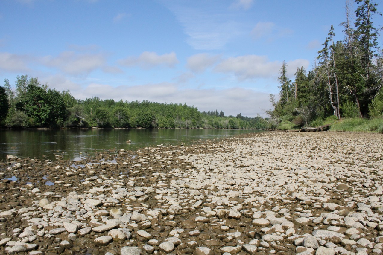
After just 4.5 millimetres of rain in the Alberni Valley over the first two weeks of June, the French Creek watershed between Port Alberni and Parksville is listed among those most seriously affected by drought. Eighteen millimetres of rain on June 18 brought a reprieve for the Alberni Valley, and more rain is forecasted for Port Alberni and Tofino this week. But the West Coast of Vancouver Island remains under a Level 3 drought listing, according to the province.
Other areas seriously impacted include the Millstone River watershed near Nanaimo, the Comox Valley’s Tsolum River, the Koksilah Watershed near Duncan, Salt Spring Island’s Fulford Creek watershed and the Chemainus River watershed near Cowichan Lake.
A June 15 bulletin from the River Forecast Centre states that Vancouver Island’s snowpack currently sits at two percent.
“Typically, two-thirds of the accumulated seasonal snowpack in BC has melted by June 15,” stated the bulletin.
“It’s so dry right now that the fry are getting stuck in pools,” said Braker of the situation in the Cowichan River. “They are trying to harvest fry to move them because they’re getting caught in pools.”
According to the Ministry of Forests’ spokesperson Vivian Thomas, watersheds are vital to the natural eco-system as they allow migrating fish - including juvenile ones - to pass through to other water channels, which is necessary for their survival. The fish can die when low water levels cause streams to heat up and have lower oxygen levels.
This year’s drier than usual winter is to blame for the early drought, said Thomas. She pointed to the June 1 snow bulletin, which shows that weather in May was “warm and dry” across B.C. The monthly temperatures were 2-3 degrees above average, with some hot spells pushing the mercury 5-8 degrees higher than typical levels. And precipitation for May was only 30-65 per cent of what is considered normal. Some cooler weather in early June started to push towards more normal levels of rainfall - but evidently not enough for many areas of Vancouver Island affected by the drought warning.
By early June, says the bulletin, most of British Columbia’s snowpack from the winter had melted to around 40 per cent. This year snow began melting earlier than usual, and by the beginning of June most areas had melted 55-100 per cent.
As a result, many of Vancouver Island’s rivers have reached record lows for this time of the year, says the province’s River Forecast Centre.
“In coastal British Columbia, including most areas of Vancouver Island, Haida Gwaii, and lowland rivers in the South Coast, streamflow is extremely low for this time of year,” stated the latest bulletin. “This is the result of rivers having minor influence from snowmelt, and both short-term and persistent long-term dry conditions.”
Water bylaws vary from location to location, so the province advises people to check with their municipality on necessary conservation measures.
Fisheries and Oceans Canada says they are not yet taking specific action related to the Vancouver Island, beyond the strict fishing closures introduced this year to protect endangered Chinook salmon from the Fraser River. Spokesperson Lara Sloan added that the DFO is constantly monitoring the salmon situation and that year-round measures are already in place to help manage populations during drought.
In an effort to deal with the situation before it escalates, the District of Tofino is implementing what they call the 20% Challenge for the first time since 2015. Tofino is part of the Level 3 drought advisory.
“Near drought conditions are becoming the new normal for West Coast summers and the district is hoping that the 20% Challenge will spark a community effort to save water in the months where we receive the least amount of rainfall,” said Ricardo Araya, Tofino’s manager of Engineering and Public Works. “The District is working closely with the commercial and industrial users to reduce their consumption and make water efficiency a priority. And we’re asking residents to look closely at their discretionary water consumption and find ways to reduce their usage by 20 per cent.”
In 2015 Tofino successfully reduced their water usage by 10,000 cubic metres compared to the previous year. Since then, the district has also taken steps to ensure water conservation is constant, rather than seasonal, and changed their bylaw to ensure that every year on May 1 Stage 1 water restrictions are implemented. Tofino’s water comes primarily from streams and reservoirs on Meares Island.


