This year has seen British Columbia’s most severe forest fire season on record, but while blazes in the province’s Interior have caused the evacuation of thousands of people, the largest on Vancouver Island has not warranted suppression efforts.
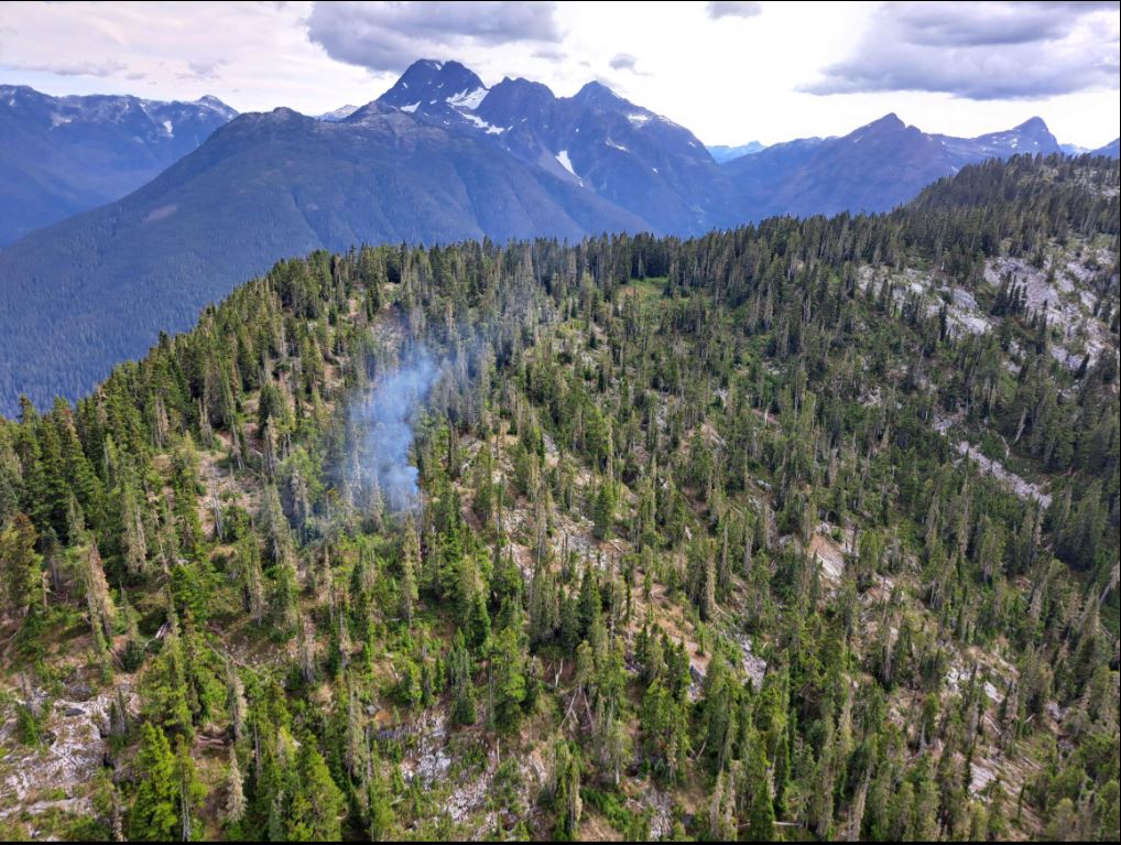
After being discovered on Aug. 6, the Mount Con Reid fire has grown to encompass 2,320 hectares on the mountains west of Buttle Lake in Strathcona Provincial Park, the edge of Mowachaht/Muchalaht territory. Although the fire is listed as “out of control” by the B.C. Wildfire Service, its elevated, remote location and stipulations in the park’s fire management plan have led the provincial agency to monitor the blaze only, leaving suppression efforts for other wildfires that are closer to communities.
“This fire is being regularly monitored but not actively suppressed at this time as it does not pose a risk to public safety or infrastructure,” stated the wildfire service. “If the fire grows to a point where it begins to threaten values, targeted action will be taken. Responder safety is a key consideration in determining what action can be taken in the steep and mountainous terrain where this fire is burning.”
Currently Mount Con Reid is being examined every other day by an aircraft patrol.
“We had an officer out on Sunday,” said Jade Richardson, an information officer with the Coastal Fire Centre. “It was burning Rank 1, which is a ground fire. We could describe it as a crawling speed, very slow, no flames visible, and then with little pockets of Rank 2, which is where that becomes a smoldering ground fire.”
Like the several forest fires burning in Strathcona park, the Mount Con Reid blaze is believed to have been started by lightning. Unlike human-caused fires, this is a natural occurrence, and sometimes when public infrastructure isn’t threatened a fire will only be monitored.
“It may be allowed to burn to achieve ecological or resource management objectives,” stated the BC Wildfire Service.
“Due to the alpine nature of it and as well that it’s burning in a provincial park where there’s a fire management plan, we don’t actually action it with crews at this time,” explained Richardson. “If there was a wind event, something changed and the fire started encroaching upon values or terrain that’s used for the park’s purposes or people to access parks, we may come and access certain portions of it.”
By the first week of September almost all of Vancouver Island was classified under a “high” fire danger rating, although a patch on the north end of Sproat Lake remained the next level up at “extreme”. With autumn on the way the wildfire service hoped that temperatures would continue to cool into the month, allowing the inevitable rainfall to eventually end the Mount Con Reid fire.
“We expect at some point this fall what we call ‘a season-ending rainfall’, which has a large impact on the moisture codes,” said Richardson.
So far over 2.2 million hectares of forest has burned in British Columbia in 2023, causing as many as 30,000 people to be under evacuation orders at one time.


